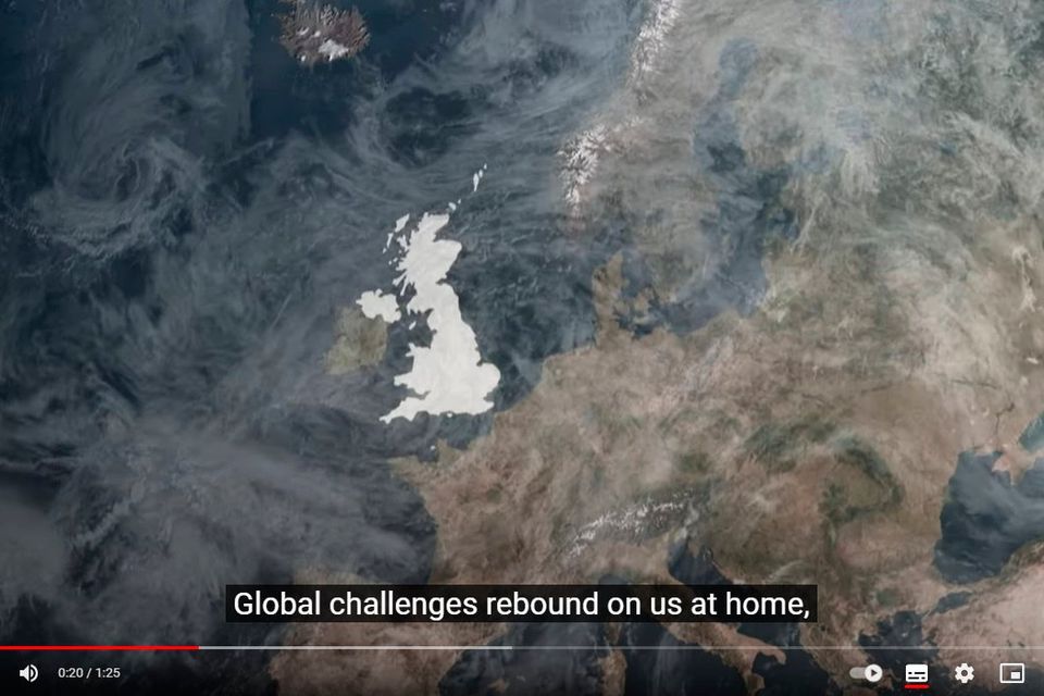
The Downing Street graphic included on the video
The UK government has said a Downing Street graphic appearing to show Co Donegal subsumed into the UK was done in error.
The graphic appeared during a one minute 25 second video clip which featured British Prime Minister Keir Starmer attending the UN General Assembly in New York last week.
Under the caption “global challenges rebound on us at home”, a map of the British Isles appears with shading over England, Scotland, Wales and a large section of the north of Ireland.
Rather than including merely the six counties of Northern Ireland, the shaded portion extends all the way to the west coast, taking in Co Donegal.
A UK government spokesperson said today: “This was a graphics error and will be updated shortly”.
The video was taken down while the error was fixed.
But the faux pas prompted a reaction online, with Reddit users poking fun at the move.
“Let them build some train tracks first, then we’ll take it back,” suggested one user.
“Writing was on the wall when they found out scone is pronounced like “gone” here,” joked another, while one Redditor suggested Downing Street might have seen “all the gorgeous beach posts”.
One user took a swipe at both the UK and Irish governments.
“We really should think about setting up our own Republic at this stage lads with people claiming us and others forgetting we exist,” they said.


