
Arrival of a cold front could hamper care for rain victims in Rio Grande do SulConcresul/Disclosure
Published 05/06/2024 11:10
After the worst phase of storms in Rio Grande do Sul has passed, authorities and meteorologists are mapping the progress of rain and floods over the next few days. The floods hinder rescue efforts and the government predicts a new cold wave starting on Wednesday, the 8th, which should also affect assistance to victims of the greatest climate tragedy in Rio Grande do Sul’s history.
“The worst is over in Vale do Taquari, in the center of the State and in the Serra, where river levels are continually falling. The most critical region is Porto Alegre and the metropolitan region”, according to MetSul’s assessment.
According to the meteorology company, the level of the Rio dos Sinos has already started to decline in the Vale do Sinos, but remains exceptionally high. The expectation is that the peak flow of Sinos will be at the beginning of the week in the final part of the basin, between Esteio and Canoas.
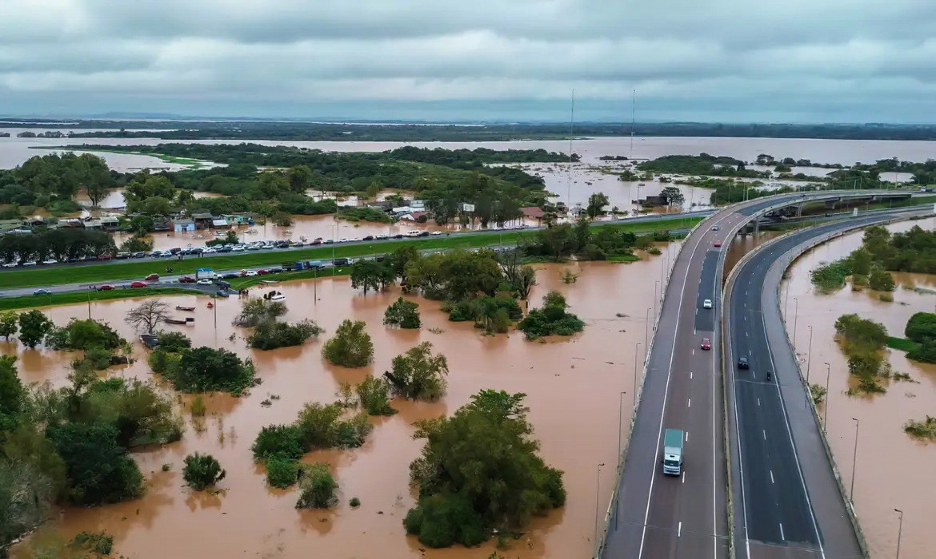
“The valley, however, remains flooded with many areas of flooding in cities along the BR-116 axis from Campo Bom to Canoas”, in Greater Porto Alegre where high water levels force residents to take shelter on the roofs of houses and wait for rescue by boat or jet ski. According to the city hall of the municipality, the third most populous in the state, 80 thousand properties were affected.
The biggest environmental disaster in Rio Grande do Sul left 83 confirmed deaths and 111 missing, according to the State Civil Defense.
The federal government recognized a public calamity for 336 municipalities (2/3 of the total) in Rio Grande do Sul on Sunday, the 5th. Several regions in Rio Grande do Sul still have islands, roads and bridges destroyed and residents waiting for rescue. There are hundreds of thousands of residents without electricity and water.
Guaíba River
In Porto Alegre, the Guaíba River reached the mark of 5.30 meters on Sunday, 5th, more than half a meter above the record for the historic flood of 1941 and 2.3 meters above the flood level. The flooding took over the streets of the historic center and the bus station, in addition to causing the suspension of the operation of four of the six water treatment plants of the Municipal Water and Sewage Department.
Even with the rain respite, the Hydraulic Research Institute (IPH) of the Federal University of Rio Grande do Sul (UFRGS) predicts “long-lasting floods, with stabilization of high water levels in the Guaíba at around 5m to 5.50m during more than four days”
The flood containment system, built in the 1970s, prevents flooding from reaching other regions. “It’s around 68 kilometers. There is a wall, in the most central part, which is approximately 2.6 kilometers long. There are also elevated roads, highways and avenues, on the banks of the Guaíba”, says Fernando Mainardi Fan, from IPH.
“As the water doesn’t come in, because of the dike system, the water doesn’t come out either. That’s why there are 23 pump houses scattered around, which pump water from inside to outside”, adds the professor.
Where is the situation expected to worsen most?
“The north wind blows until Wednesday, the 8th, flowing the waters into Lagoa dos Patos. The entry of a south wind with colder air should occur on Thursday, the 9th, but the south wind should not be very strong”, he projects. MetSul.
Lagoa dos Patos is the largest lagoon in South America, 265 kilometers long and with a surface area of 10,144 km². Lagunas are bodies of salt or brackish water separated from the sea by narrow rock formations or sandbanks.
Among the largest cities nearby are Pelotas and Rio Grande.
The flood of the Guaíba River that floods the streets of Porto Alegre is still expected to take days to return to safe levels.
“Where does the enormous amount of water from Greater Porto Alegre go. Coastal cities, such as Pelotas and Rio Grande, will have floods that are expected to be severe”, warns Metsul.
Over the weekend, the state Civil Defense and local authorities have warned to evacuate risk areas. Pelotas city hall opened two more new shelters to welcome residents. In Rio Grande, the municipal authorities even used school buses to remove residents from areas threatened with flooding.
Cold wave can drop the temperature to 10º C
The Southern Military Command reported that the weather forecast is for a window of good weather in most of Rio Grande do Sul until Tuesday, 7th, which is considered “good news”. There should, however, be rain this Monday, 6th, in the extreme south of Rio Grande do Sul.
What worries the CMS, however, is the forecast of a drop in temperature in the State on Wednesday, 8th, with temperatures falling by up to 10ºC. The cold wave can worsen hypothermia among people in need of rescue.